Search history
Clear allSearch by image
XDrag and drop an image here or upload an image
Max 5MB per image
UploadSign In | Join
Search history
Clear allSearch by image
XDrag and drop an image here or upload an image
Max 5MB per image
UploadSign In | Join
X Email Mobile
| Number | Unit-price | Total | |||
| I want to buy: | × | 690.0 | = | 0 |
A new item has been added to your Shopping Cart. You now have items in your Shopping Cart.
Packaging information
CTN Size: 58 × 87 × 32 cm
G.W./CTN:20 kg
QTY/CTN:4 piece/carton
Note: Confirm the delivery time before placing an order.Exclamation mark!
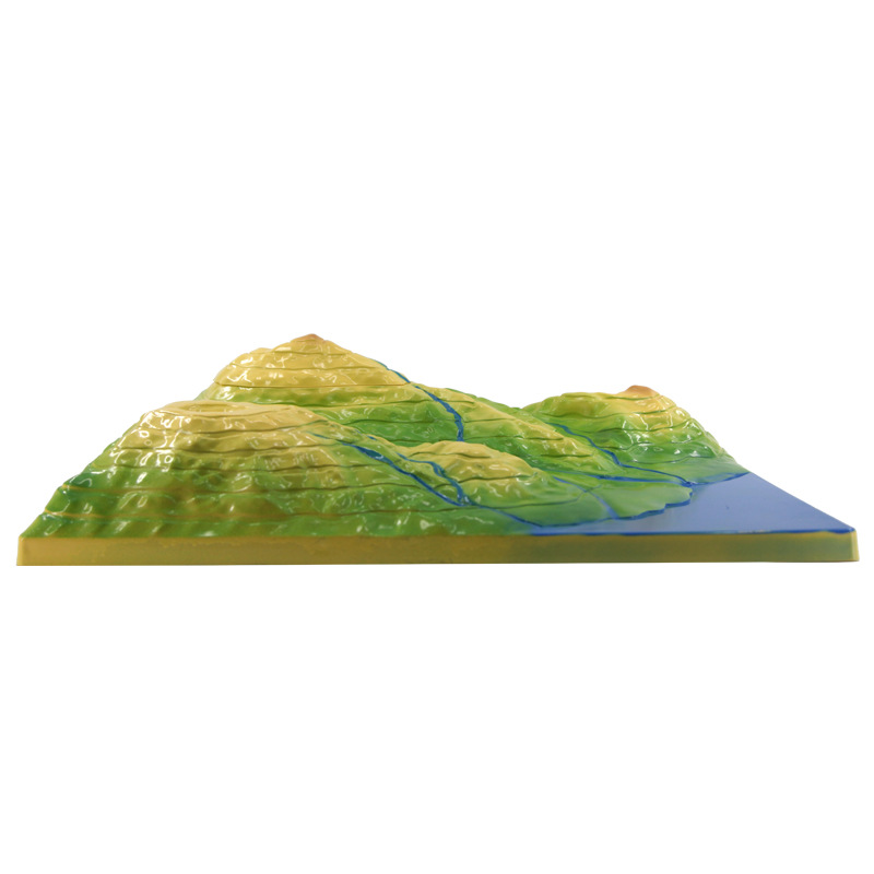
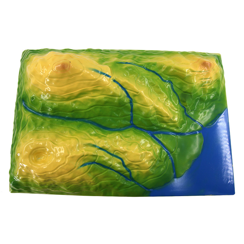
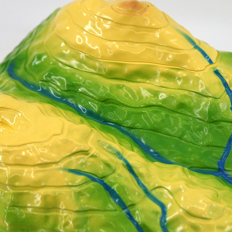
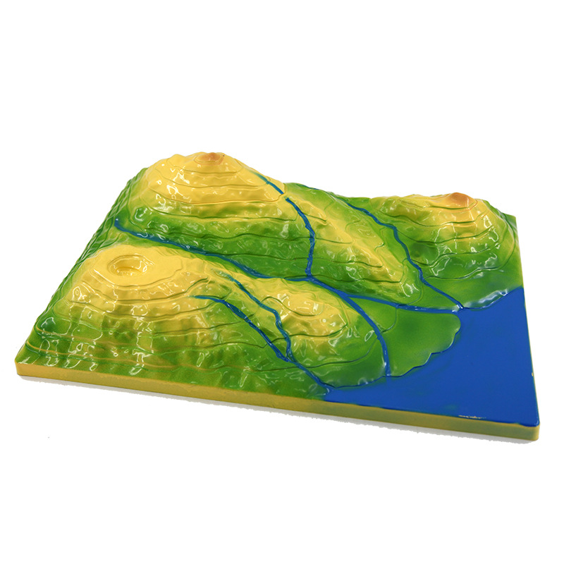
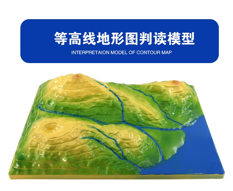
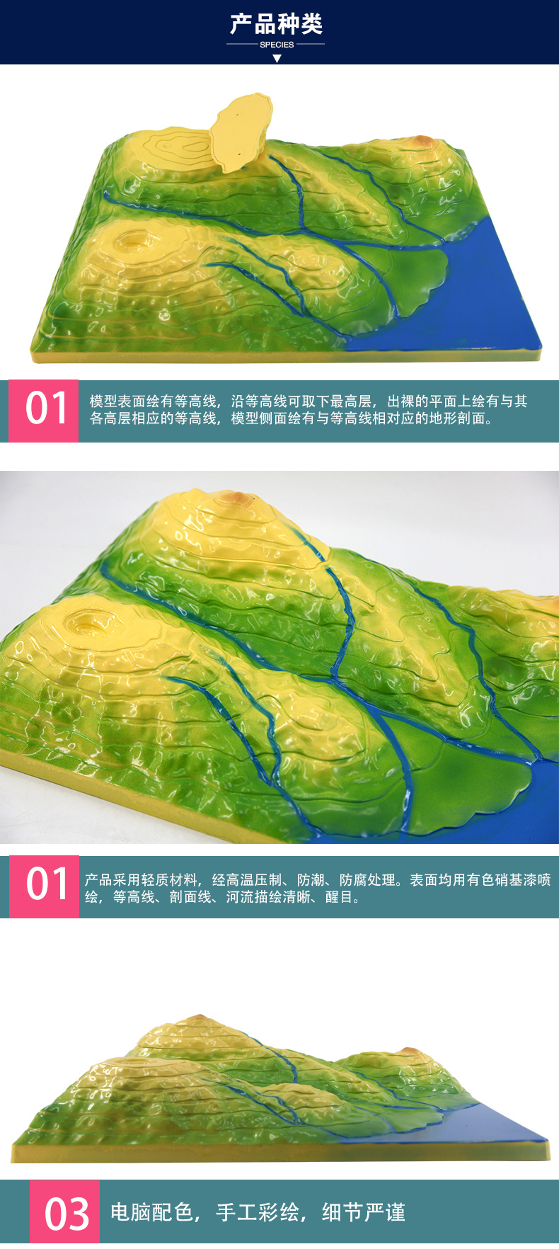
【Contour Line Topographic Map Interpretation Teaching Model】Professional teaching tool, accurately simulates real terrain, helping geography teaching be more intuitive! Made of eco-friendly materials,
Safety and durability. Key selling points: 1:10,000 scale, clearly displays contour line changes, enhancing students' spatial imagination. Solves user pain points:
Traditional teaching is abstract and difficult to understand, but this model makes learning more intuitive and efficient. It has passed the national educational equipment certification, ensuring quality. It makes geography learning simple and interesting.
Foster students' curiosity about exploring nature!


Update time:


TOP