Search history
Clear allSearch by image
XDrag and drop an image here or upload an image
Max 5MB per image
UploadSign In | Join
Search history
Clear allSearch by image
XDrag and drop an image here or upload an image
Max 5MB per image
UploadSign In | Join
X Email Mobile
| Number | Unit-price | Total | |||
| I want to buy: | × | 9800.0 | = | 0 |
A new item has been added to your Shopping Cart. You now have items in your Shopping Cart.


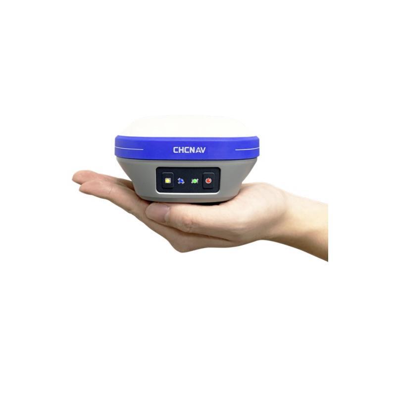
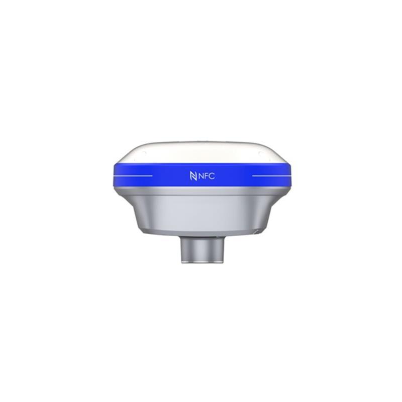
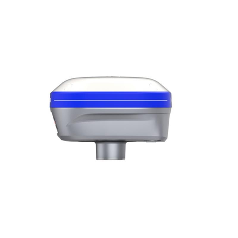
Hua Ce X6 Inertial Navigation Version Five-Star Twenty-One Frequency RTK Surveying System
X6Inertial Navigation Pocket EditionRTK是一款全新的GNSSReceiver, supports Huace5Star21Frequency solution, integrated inertial navigation module, achieves free-collocation measurement, enhancing user experience.20% plusWork efficiency; The complete machine design is exquisite and compact, making it easier to carry and less tiring to work, making it the preferred product for your measurement tasks. It allows you to experience the high technology of the new era. Inertial navigation version pocket.RTKWill surely lead the new trend of surveying and mapping equipment, making measurements reach new heights.
Features:
Wherever you want to measure, measure it.
Point-and-measure, measure anywhere you want. Align the tip of the center rod with the target point, tilt to obtain accurate coordinates. Focus on solving the difficult, impossible, or unsafe measurement scenarios, addressing customer pain points and improving work efficiency.
Free from the middle, efficiency increased by 20%+
Point-and-measure, measure anywhere you want. Align the tip of the center rod with the target point, tilt to obtain accurate coordinates. Focus on solving the difficult, impossible, or unsafe measurement scenarios, addressing customer pain points and improving work efficiency.
Adopt HCE600 Android tablet
Large screen, clear display under strong light.
5.5High-brightness large screen, measuring the bottom map shows more comprehensive and intuitive, even in the sun, it is still clear.
Fan
High configuration, no stuttering with graphic-intensive tasks.
An octa-core processor, Android 10 system, no stuttering when importing CAD drawings with graphics.
Lightweight and compact, easy to operate
The handbook is only 1.54cm thick and weighs only 345g. It is designed based on human engineering to hold the handbook, and supports quick side measurement keys, making field work easier.
Built-in eSIM, free mapping traffic for three years
The handheld device integrates an eSIM card, making it easy to start working without the hassle of setting up a traditional SIM card.
Geodesy 8.0 graph operation smoothness improved by 52%, seamlessly compatible with 99.9% of CAD drawings
>Refresh Quickly
Based on the self-developed 'MetaCAD' two-dimensional and three-dimensional integrated graphics engine, with millisecond-level dynamic response, the smoothness of graphic operations has been improved by 52%.
>All-round Display
By using the 'CAD Plug-in' technology, it can automatically identify external reference files and seamlessly integrate with 99.9% of CAD drawings. The cloud-based AutoCAD combined with the TianZheng system excellently resolves the issue of TianZheng drawing display being in a mess or data loss.
CGO2.0Comprehensive Measurement Data Post-processing Software
>Multi-functional integration: static, road, power, UAV post-processing multi-functional integration, one software solves problems in multiple industries
>Inside and Outside—Body: Real-time upload of field data back to the interior work, improving the efficiency of communication between inside and outside work.
>Image superimposition: Measurement data and satellite image maps are superimposed to display, providing an intuitive way to show and check the measurement results.
>Number of figures: data and graphics linkage, intuitive verification of the results of line editing
Industry Application:
RTKApplication in Topographic Mapping
Topographic mapping is widely applied in engineering construction, which is a complex and diverse process involving a wide range of types. In engineering construction, topographic mapping is a basic prerequisite, so the quality of the results is particularly important. However, traditional topographic mapping has disadvantages such as long mapping cycles and low accuracy. It involves using total station instruments, platy surveying instruments, and so on to plot the measured detail points on the drawings, and to depict the terrain and landforms by hand. The emergence of GNSS technology allows for high-precision and rapid determination of the coordinates of various control points and on-site mapping.
RTKApplication in road construction surveying and laying out
In traditional road construction, the main method is to use total station or other measuring equipment to extract some feature points from the design documents to determine the coordinates of the sample points. This method requires a large amount of manual calculation, leading to low measurement efficiency. In addition, due to the reasons on the site, some feature points cannot be measured, and it is necessary to change the mileage, etc. Therefore, the field needs to carry a lot of auxiliary documents and tools such as drawings and calculators. However, the software of Huace RTK can directly import the design parameters of the level curve, vertical curve, standard cross section, super height, widening, slope, structural elements, etc., which is equivalent to importing the entire road design data into the handbook. In the field, the software can display the current mileage, cross slope, filling and digging value in real time according to the position of the mobile station, which basically avoids the dependence on the drawings and calculators. The efficiency of field measurement has been greatly improved.
RTKApplication in Underground Pipeline Detection
The most important part of pipeline measurement is to determine the planar position, direction, depth, and related attributes of the pipeline. In the traditional pipeline measurement model, the field exploration results need to be recorded by sketching the depth, connection relationship, material, pipe diameter, well depth, and more than 10 other attribute information, which is very inconvenient and difficult to preserve the results. For complex pipelines, field personnel also need to carry paper maps to assist judgment, and the field efficiency has always been unable to improve; when doing internal work at night, it is necessary to re-sort the sketch results. Generally, the results of field measurement for 8 hours need to take 4-6 hours, and there is too much repetition between internal and external work. This leads to a large amount of work for the front-line measurement personnel in the pipeline measurement industry, and a high rate of personnel turnover.
Hua Ce RTK has a complete set of solutions for the detection of underground pipelines. Combining with high-precision mapping equipment such as X6 RTK, the operation advantages in pipeline detection can reduce the investment in manpower and material resources, significantly improving work efficiency. The operation is not limited by weather and environment, making it very suitable for long-distance pipeline measurement and underground pipeline survey work.
RTKApplication in soil measurement
The calculation of earthwork volume is an important step in construction engineering. During the design stage before construction, it is necessary to budget the volume of earth and stone, which directly affects the preliminary cost estimate of the project and the selection of the optimal scheme. In some engineering projects in reality, disputes caused by the accuracy of earthwork volume calculations are often encountered. How to quickly and accurately calculate the earthwork volume using the topographic data measured on-site or the original digital terrain data has become a concern of increasing importance to people.
Now take a park as an example, the case uses the instrument is Hua Ce E90; the project: land leveling of the park.
RTKApplication in Power Exploration and Foundation Section
This project uses the X6 from Huace Company, along with Huace's data transmission radio, handbook, and software for operation.
Overhead power transmission line surveying and design are mainly to determine the line's route, as well as the precise measurement of the surrounding objects, other important facilities, and threats to the safety of the line. The measured data must be provided to the design team for the design of overhead lines. Therefore, the measurement data results must be compatible with the power design software. Currently, Hucheng's measurement data is seamlessly compatible with Beijing Daohong and Bosch power design software.
Parameter
|
Project |
Content |
Parameter |
|
Receiver Characteristics |
Satellite Tracking |
1408Channel, supports the entire BeiDou constellation, supports the BeiDou Generation III satellites. Support 21st Century Five-Star |
|
Operating System |
LINUXOperating System |
|
|
Initialization Time① |
<5STypical Value |
|
|
Initialization Reliability |
>99.99% |
|
|
Receiver appearance |
Button |
1individual movementSlashStatic Switch Key1Power button |
|
Indicator light |
1A differential traffic light,1A satellite light,1A static data acquisition light.1Power light |
|
|
Nominal accuracy② |
Static accuracy |
Plane accuracy:"±(2.5+ 0.5×10⁻⁶×D) mm |
|
Height accuracy:"±(5+0.5×10⁻⁶×D) mm |
||
|
RTKPrecision |
Plane accuracy:"±(8 + 1×10⁻⁶×D) mm |
|
|
Height accuracy:"±(15+ 1×10⁻⁶×D) mm |
||
|
Single-machine precision |
1.5m |
|
|
"码差分精度"可以翻译为 "code differential accuracy"。③ |
Plane accuracy:"±(0.25 + 1×10⁻⁶×D) m |
|
|
Height accuracy:"±(0.5+ 1×10⁻⁶×D) m |
||
|
GNSS+Inertial Navigation System",缩写为"INS④ |
Inertial Measurement Unit |
200Hz |
|
Inclination angle |
0~60° |
|
|
Tilt Compensation Accuracy |
10mm + 0.7mm/° tilt(30°Internal precision 2.5cm) |
|
|
Electrification parameters |
Battery |
"内置"的英文翻译是 "built-in".6800mAhLithium battery, supports mobile station20Hour endurance |
|
External Power Supply |
SupportUSBExternal power supply for the mouth |
|
|
Physical properties |
尺寸(长AsteriskwideAsteriskHigh) |
119 mm * 119 mm * 85mm |
|
Weight |
0.73kg |
|
|
Material |
Magnesium alloyAZ91Dairframe |
|
|
Working temperature |
-45"℃" is the symbol for Celsius temperature scale.~+75"℃" is the symbol for Celsius temperature scale. |
|
|
Storage temperature |
-55"℃" is the symbol for Celsius temperature scale.~+85"℃" is the symbol for Celsius temperature scale. |
|
|
Waterproof and Dustproof |
IP68level |
|
|
Impact vibration |
IK08level |
|
|
Anti-fall |
"抗"在中文中通常指的是"against"或"resistance"。2Mile Free Fall |
|
|
Data Output |
Output Format |
NMEA 0183Binary code |
|
Output Method |
BT/Wi-FiRadio station |
|
|
Static Storage |
Storage Format |
Can be directly recordedHydrogen CyanideandHuman Rights CampaignandRINEX |
|
Storage space |
Standard configuration8GB内置存储 |
|
|
Download Method |
GeneralUSBData DownloadHTTPDownload |
|
|
Data Communication |
I/Ointerface |
1ExternalUHFAntenna Interface |
|
1个USB-TypeCInterface, supports charging, power supply, data download |
||
|
Network Module |
Handbook Support4GFull-network access |
|
|
Radio station |
Built-in high-frequency450-470MHzsingle-receiver radio station |
|
|
Bluetooth |
BT4.0Downward compatibilityBT2.xCompatibleWindowsandAndroidandIOSSystem |
|
|
Data Transmission |
Wi-FiData Link |
|
|
Wi-Fi |
802.11 b/g/n |
|
|
NFC |
SupportNFC闪连 |
|
|
Receiver function |
Super Double Harvest |
Support RadioplusNetwork two-way data differential simultaneously, providing comprehensive data services |
|
One-click Matching |
Support for one-click matching of base station data with the handbook software |
|
|
Handbook parameters |
Model |
HCE600Android Measurement Notebook |
|
network |
4GUniversal support, built-ineSIMGift of Three-Year Surveying and Mapping Traffic |
|
|
Operating System |
Android 10 |
|
|
CPU |
octa-core2.0GHzProcessor |
|
|
LCD screen |
5.5''High-definition display |
|
|
Battery |
battery life" 或 "range14hour |
|
|
Waterproof and Dustproof |
IP68 |
AsteriskAny changes to the technical parameters and configurations of our company's products will not be notified in advance.
Note:
1It may be affected by atmospheric conditions, signal multipath, obstacles, and the satellite's geometric position.
[2]Accuracy and reliability can vary due to factors such as multipath, obstacles, satellite geolocation, and atmospheric conditions. It is recommended to set up the instrument in an open area with minimal electromagnetic interference and multipath effects. The baseline should be longer than...30When kilometers need precise ephemeris, it may take as long as24Observation time of one hour is required to achieve the high-precision static standard indicators.
[3]Depends on the system performance of the system providing code difference data.
[4]Strong vibrations, rapid rotation, and improper operation may affect the inertial navigation accuracy.
This factoryProfessional manufacturer of geodetic-type full-constellation RTK products! Among them, (Hucal RTK) has a large number of orders, and can wholesale Hucal X6 inertial version 21-frequency pocket RTK, providing Hucal RTK prices at any time. This is the RTK manufacturer_This factory."
Update time:


TOP