
Search history
Clear allSearch by image
XDrag and drop an image here or upload an image
Max 5MB per image
UploadSign In | Join
Search history
Clear allSearch by image
XDrag and drop an image here or upload an image
Max 5MB per image
UploadSign In | Join
X Email Mobile
 size
size
|
CN¥ 0.0 |
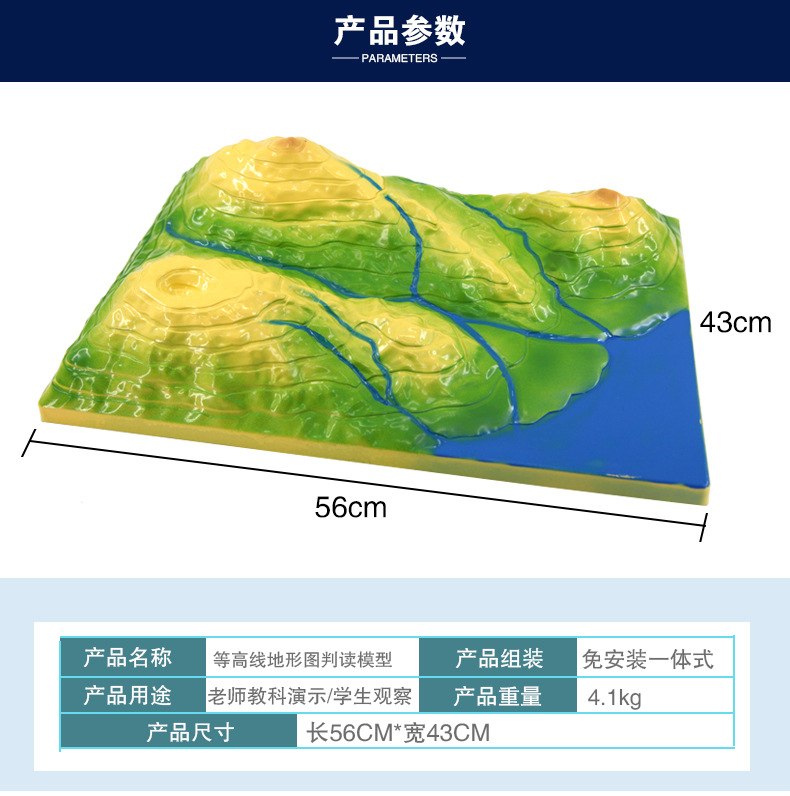
 56 * 43cm
|
CN¥ 0.0 |
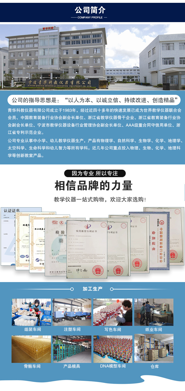
Qinghua science instruments 14yr.
Contacts zheng Chat
Mobile 86-13750965003
E-mail 2403396147@qq.com
13750965003

Note: Please confirm the delivery date before placing an order!
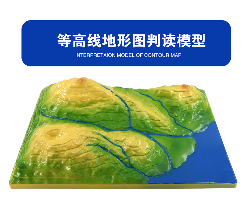
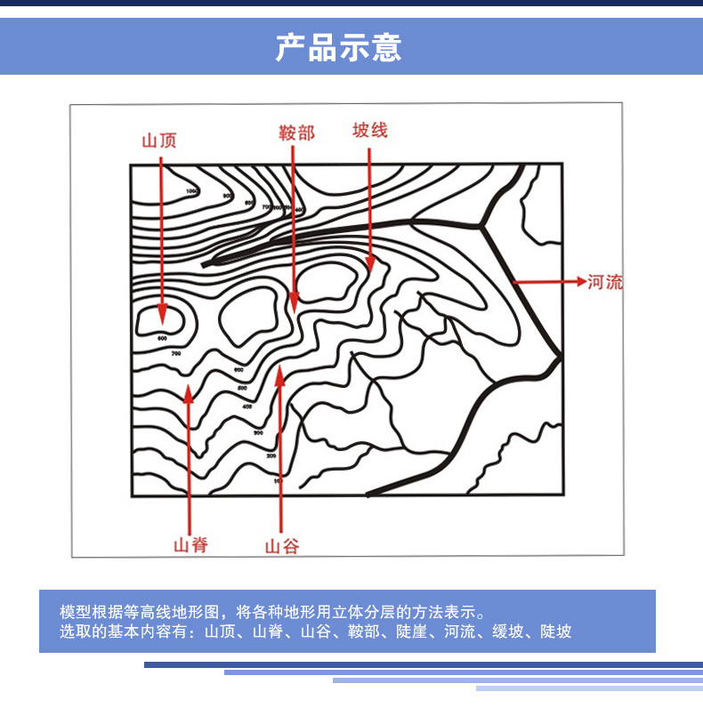
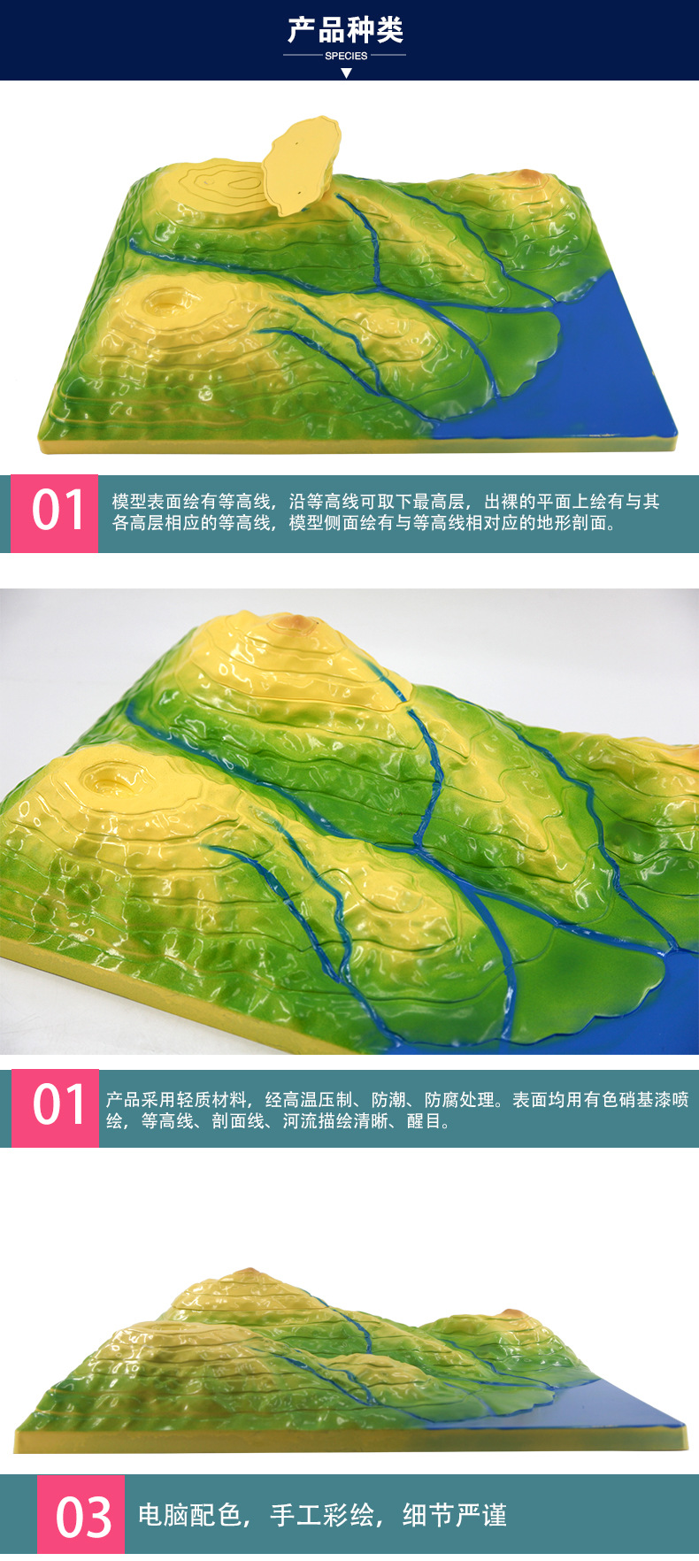
Contour Terrain Map Interpretation Model, Geographical Landform Education Instrument for Junior and Senior High School, Modular Design, Intuitive Display of Terrain Undulations.
Core selling points: safe materials, precise contour lines, interactive teaching.
Product advantages: lightweight and durable, easy to operate, improving learning efficiency.
Addressing user pain points: Visualizing abstract concepts to stimulate geographic interest.
Brand endorsement: CE certified, quality reliable.
Emotional resonance: Helping students explore the mysteries of nature, cultivate scientific thinking, and make geography learning more vivid and interesting.


Update time:


TOP


