X Email Mobile
| Number | Unit-price | Total | |||
| I want to buy: | × | 30.0 | = | 0 |
A new item has been added to your Shopping Cart. You now have items in your Shopping Cart.
Yiwu zhong bang optical instruments 14yr.
Main Products:Magnifying glass,compass,microscope
Contacts:tanghuangChat
Mobile:86-15381755289
E-mail: WeChat:13185795648
Address:24206A,24206B,24189,24190A,24190B, 4 Street, 2 F, 55 Gate, International Trade Mart (District 3).


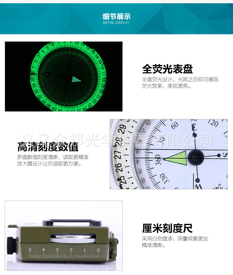
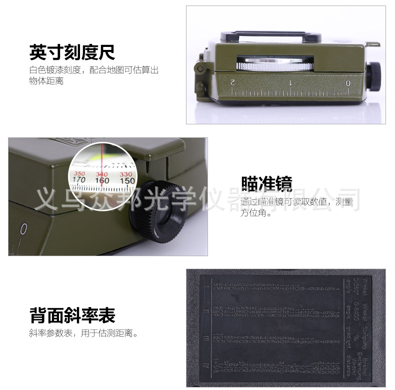
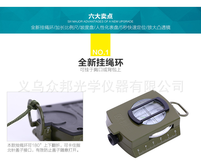
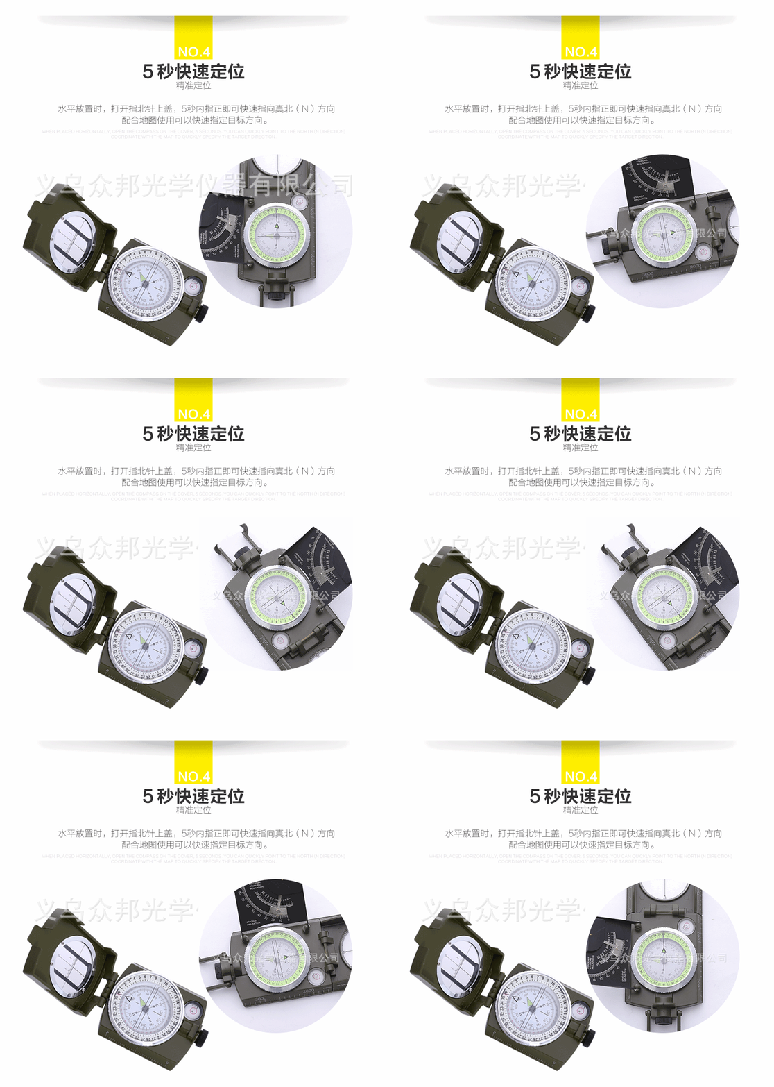
High-end American Military Green Compass
1. Measure bearing angle:
Unfold the compass, rotate the directional frame to align the gradations on the directional glass with the directional indicator, place the leveling lens at an angle (45°), look through the sight at the target with one eye, and observe the position markings above the anticlockwise directional indicator on the reflection from the leveling lens. This will allow you to read the target bearing angle. Then, use your right hand to rotate the directional frame to align the gradations on the directional glass with the N pole of the magnet. The angle between the directional indicator and the gradations on the directional glass is the target bearing angle (calculated in a clockwise direction).
Open the compass and set the map (distance measurement can be without setting the map), insert a needle at the baseline point on the map, rotate the compass to make the side scale cut the target point, and you can read the azimuth angle from the baseline to the target point.
2. Calibrate the map:
Unfold the compass, rotate the directional frame, align the scale lines on the directional frame with the directional indicator (note the correction for magnetic declination), place the compass flat on the map, with the sight end pointing towards the map's northern pole, so that the coordinate ladder is tangent to the map's magnetic meridian, rotate the map to align the compass's N pole with the scale lines on the directional glass, at this point, the map is marked.
3. Determine the marching direction towards the concealed target:
Unfold the compass on the map and align the measuring scale with your starting point and the military target. At this time, the direction indicator indicates the direction you should advance. Rotate the direction frame to align the (S, N) direction on the compass glass with the (S, N) direction on the map, and then record the direction angle reading indicated by the direction indicator. Face the direction indicator and pick up the compass to rotate the body, align the magnetic needle N pole with the scale lines on the compass glass, and at this time, aim through the sighting door forward. All objects (such as forests, houses, etc.) on this alignment line can be used as auxiliary targets for military direction. After recognizing the auxiliary target, you can proceed forward. Close the compass and put it in the bag, but do not rotate the direction frame. When you reach the auxiliary target, you can find a new auxiliary target to continue to advance until the destination. Along the way, you should frequently check the direction reading.
4. Known target interval, estimate the distance from the target to the standing point:
① Aim at the target through the sight's left and right tips, estimating the target's distance based on the multiples of the width between the sight's left and right tips, following the 10:1 ratio formula.
The distance from the target to the standing point (in meters) = the target interval width (in meters) x 10 / the multiple of the target interval relative to the width of the crosshair's two tips.
Example: There is a road parallel to our position in front, and I need to find the distance between the road and the position.
There are electric poles along the road, with a distance of 50 meters between each pole. Using a distance estimator, it was measured that there are 5 poles between the left and right tips, which means that each interval between poles is 1/4 of the distance between the left and right tips. According to the proportion formula, the calculation is as follows:
The distance between the road and the position is 2000 meters.
② Utilize the distance to the target using auxiliary points
Use the sighting device to aim at the target, turn the directional frame to align the scale with the magnetic needle's N pole, and record the bearing angle reading indicated by the direction indicator. Then, turn to the left or right at a right angle (i.e., 15 degrees from the original bearing reading) to find a secondary point. Use the step measurement method or another method to measure the distance from the secondary point to the standing point. At the secondary point, use the compass through the sighting device to aim at the original target, turn the directional frame to align the scale with the magnetic needle's N pole, and record the reading indicated by the direction indicator. By subtracting the difference in the angle readings from the two directions and the distance from the standing point to the secondary point, you can find the target distance in Table 2.
If the difference between the two direction angle readings is 7-50 degrees (i.e., 45 degrees), then the target distance equals the distance from the standing point to the auxiliary point.
5. Measure pitch angle:
Turn the target face down and aim at it with the sighting crosshair. Use the level to reflect the elevation angle reading. Alternatively, stand the target face up on a flat surface and measure the angle of inclination of the surface.
6. Measure the height:
Measure the height using a map and a height gauge. First, determine the horizontal distance from the starting point to the target on the map. Then, use a compass to measure the elevation angle, and look up the height on the height gauge. Alternatively, you can also calculate the height using trigonometric functions. For example, to find the height from the base of a mountain to the summit.
The horizontal distance from the summit to the standing point as measured on the map is 100 meters. With a compass, the elevation angle of the summit is 40 degrees. By referring to the height table at 100 meters and the 40-degree angle, the height can be determined to be 83.91 meters.
7. Measure the distance between any two points on the map:
The relationship between the grid side length and actual distance on maps of different scale can be calculated using the following formula:
1. For a 1:10,000 scale map:
Grid side length = 100 meters
Actual distance = 1000 meters
2. For a 1:50,000 scale map:
Grid side length = 200 meters
Actual distance = 10,000 meters
3. For a 1:100,000 scale map:
Grid side length = 400 meters
Actual distance = 40,000 meters
4. For a 1:250,000 scale map:
Grid side length = 800 meters
Actual distance = 200,000 meters
5. For a 1:500,000 scale map:
Grid side length = 1600 meters
Actual distance = 400,000 meters
6. For a 1:1,000,000 scale map:
Grid side length = 3200 meters
Actual distance = 1,000,000 meters
Please note that these calculations are based on the assumption that the map is a square grid. If the map is a rectangular grid, the side lengths will be different.
1:25000 map: Distance = (measured millimeter number / 4) X 100 (meters)
1:50000 map: Distance = (measured millimeter number / 2) X 100 (meter)
1:100000 map: Distance = measured millimeter number X 100 (meters)
8. Magnetic declination measurement:
The direction of the Earth's magnetic north and south poles is not exactly on the true north-south axis, so the compass points to the direction of the true north and south with a deviation angle, which is known as the magnetic declination. The value of this angle varies from place to place. When not requiring precise measurements, one can consider the direction indicated by the compass as the true north. When precise measurements are needed, one should first check the magnetic declination table for the area, and then calculate the true north-south direction based on the direction indicated by the compass. For example, in Changsha, when using a compass, the magnetic declination is 2°41' (West). This means that the direction indicated by the compass for north in Changsha is west of the true north by 2°41'.
Method for Calculating Magnetic Declination Anywhere.
On a clear night, spread out the compass, rotate the directional frame, and make the (N) on the directional glass directly face the directional indicator. Use the sighting, sighting, leveling glass, and night light markers to face the North Star, without changing the direction of the compass, place the compass flat, and the reading indicated by the magnetic pole of the compass is the magnetic deviation angle of the location.
Maintenance and Maintenance:
1. Do not place the compass near ferromagnetic objects, high-voltage lines, or electromagnetic devices, as this may cause errors and reduce the compass's sensitivity.
2. When not in use, it should be placed in a place with good ventilation and dryness to prevent mold.
3. When the surfaces are contaminated, use a white fluffy cloth to gently wipe the surface to maintain its smoothness. Our company mainly deals in magnifying glasses, compasses, telescopes, etc. Adhering to the business philosophy of "Customer First, Forward-looking and Enterprising," we adhere to the principle of "Customer First" to provide high-quality services for our customers. Welcome to visit!
Our company mainly deals in magnifying glasses, compasses, telescopes, etc. Adhering to the business philosophy of "Customer First, Forward-looking and Enterprising," we adhere to the principle of "Customer First" to provide high-quality services for our customers. Welcome to visit! Our company mainly deals in magnifying glasses, compasses, telescopes, etc. Adhering to the business philosophy of "Customer First, Forward-looking and Enterprising," we adhere to the principle of "Customer First" to provide high-quality services for our customers. Welcome to visit!
Update time:
TOP